The Orbit is envisioned as a community that will help us grow while preserving our agricultural lands and natural landscapes. It will encourage high-density living instead of suburban sprawl, mixing small town with urban living.
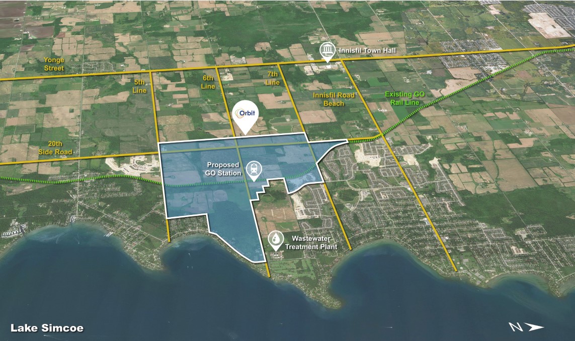
The Orbit is planned to be a transit-oriented community built around the proposed Innisfil GO Station by 6th Line and east of 20th Sideroad. Growth won't happen overnight—we're planning the Orbit to 2050 and beyond to ensure the growth of Innisfil feels progressive and responsibly managed over time.
Project status
The Town of Innisfil adopted the Orbit Transit Oriented Community Vision in 2019. The next step to make this vision a reality is to develop an engineering and planning document called the Orbit Potential and Innovation Plan (OPIP). The OPIP is our coordinated Master Servicing Plan and Secondary Plan that will guide the implementation of Innisfil’s vision for Orbit: a community that will help us grow while preserving our agricultural and natural landscapes.
Read the latest update (June 2025)
Minister's Zoning Order and Transit-Oriented Communities |
|
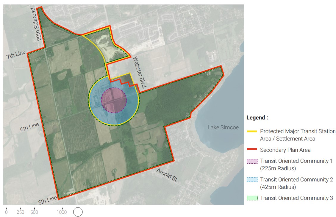
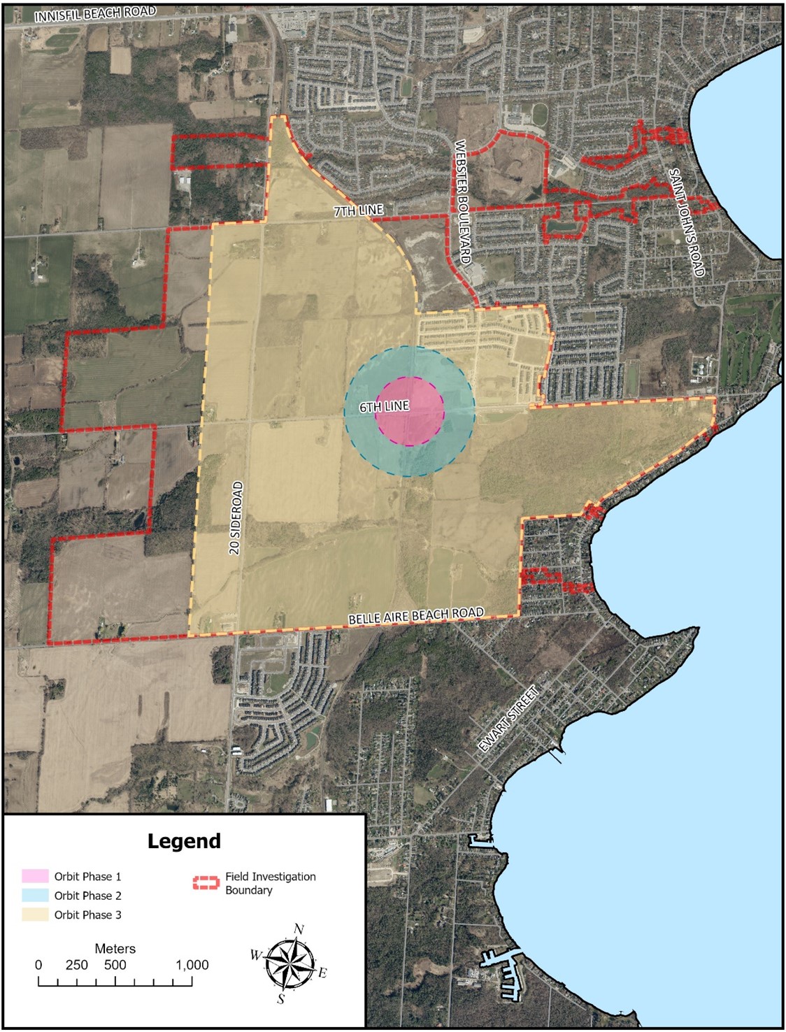
A Minister’s Zoning Order (MZO) was initiated to provide economic certainty for private investment in the necessary infrastructure and to help expedite the development of the proposed Innisfil GO Station. An MZO was issued on August 6, 2021 and includes regulations for two zones: Transit-Oriented Community 1 (TOC 1) and Transit-Oriented Community 2 (TOC 2). The MZO regulations are embedded in the Secondary Plan, providing direction related to maximum heights, minimum densities and land uses. A Transit Oriented Community (TOC) as per the Transit-Oriented Communities Act, 2020 can be defined as, “a development connected with the construction or operation of a transit station that is part of a priority transit project, and includes a development located on transit corridor land within the Building Transit Faster Act, 2020.” Transit-Oriented Community 1TOC 1 includes all lands within a 225-metre radius of the intersection of 6th Line and the rail corridor. The MZO directs that TOC 1 shall have:
Transit-Oriented Community 2TOC 2 includes lands within a 225-metre to 425-metre radius from the intersection of 6th Line and the Metrolinx Barrie rail corridor. The MZO directs that TOC 2 shall have:
Transit-Oriented Community 3TOC 3 refers to the extent of the Secondary Plan Area beyond a 425-metre radius from the intersection of 6th Line and the Metrolinx Barrie rail corridor. The MZO does not provide regulatory direction for TOC 3. While the TOC 3 area is not subject to the MZO, the planning for the TOC 3 lands will respond to the development and infrastructure that is currently being implemented within the TOC 1 and TOC 2 MZO lands.
|
Orbit Secondary Plan (Official Plan Amendment) |
|
A Secondary Plan is a land use plan for a particular area of a municipality that:
The Orbit Secondary Plan was approved by Town Council on February 28, 2024. It will require final approval by the County of Simcoe. It covers themes such as:
|
Water and Wastewater Servicing Plan |
|
InnServices has completed a town-wide Water and Wastewater Master Servicing Plan Update (MSP Update). This MSP Update identifies water and wastewater servicing solutions to accommodate future population and employment growth in the town up to 2051. The MSP Update was prepared in accordance with the Municipal Class EA process. Key infrastructure upgrades for both the water and wastewater servicing will be required in different timeframes (short-term, mid-term and long-term) from now to 2051 to address immediate and long-term growth needs. The MSP process started in May 2023 and included two public open houses (August 2023 and April 2024). Notice of completion was issued in December 2024. |
Orbit Stormwater Master Servicing Plan |
|
The Town of Innisfil is creating a Stormwater Master Servicing Plan (MSP) for the proposed new community of Orbit. The MSP will help:
Orbit Stormwater Master Servicing Plan - Open HouseWe held a drop-in open house to introduce the project and hear initial feedback in December 2024. View the open house display boards for more information. The study area is shown in the image below. For now, the study includes the first two phases of development. The third phase may be included later in the study. Review the Notice of Commencement for more information.
|
Planning framework
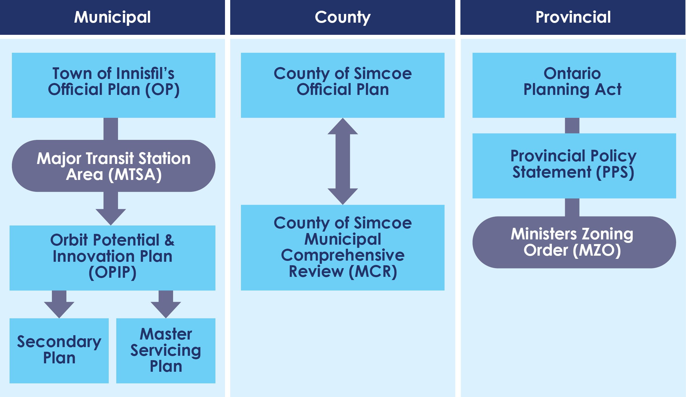
The Orbit Potential & Innovation Plan (OPIP) plays an important role in the overall multi-tiered planning process here in Ontario. The Orbit project is being evaluated at the provincial, regional and municipal levels to ensure the responsible development of this proposed community.
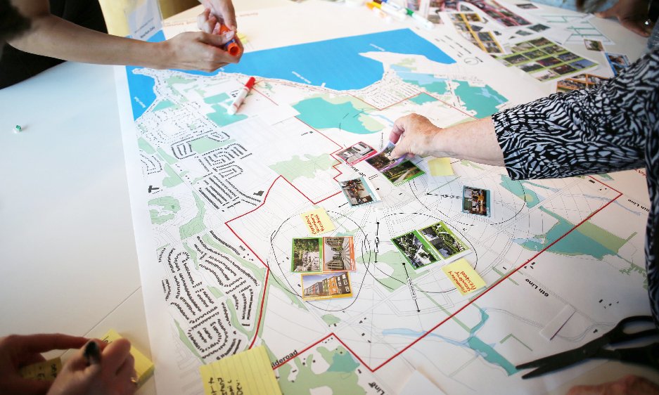
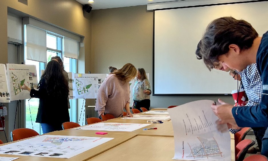
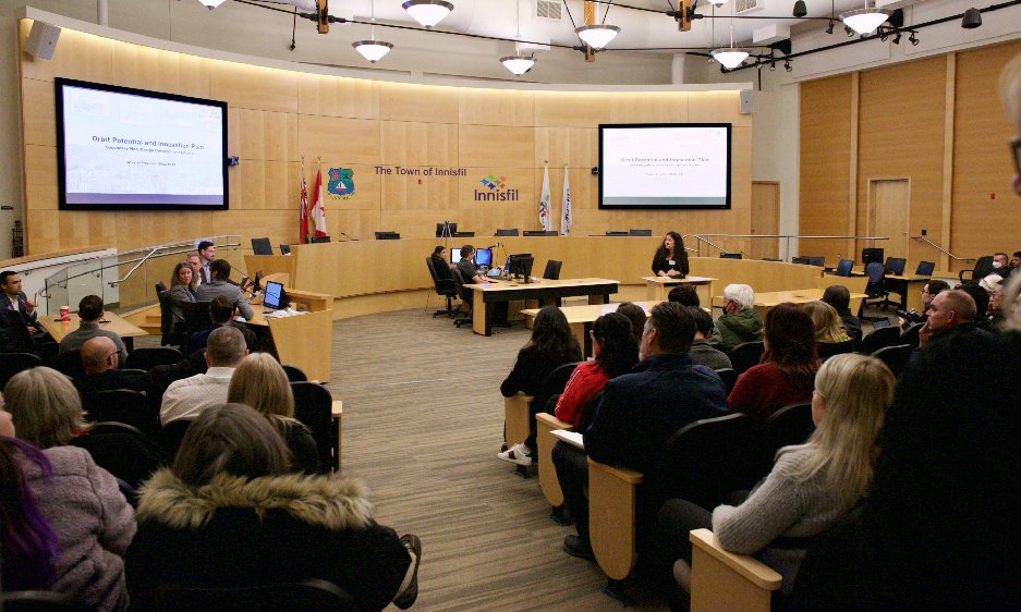
At each level of planning, significant public input will inform each of the frameworks from draft to their final state. The Orbit Potential & Innovation Plan will be no different and we strongly welcome the participation of all stakeholders that would like to have their say as we progress the OPIP forward.
Provincial Framework (Province of Ontario) |
Ontario Planning ActThe Ontario Planning Act is provincial legislation that sets out the ground rules for land use planning in Ontario. It describes how land uses may be controlled and who may control them. The Planning Act sets outs matters of provincial interest that apply to the Orbit Potential and Innovation Plan, including:
Provincial Policy StatementThe Town of Innisfil is committed to grow in line with the Provincial Policy Statement and the Places to Grow: Growth Plan for the Greater Golden Horseshoe (“Growth Plan"). These provincial policies provide a framework that supports the growth of stronger, complete communities, a thriving economy, a clean and healthy environment, and social equity. Minister's Zoning OrderSection 47 of the Planning Act allows the Minister of Municipal Affairs and Housing to make “Minister’s Zoning Orders” to govern land uses within areas subject to the order. An MZO was issued on August 6, 2021 and includes regulations for two zones: Transit Oriented Community Zones 1 and 2. Note the MZO related to Orbit only applies to 425-metre radius from the centre of Orbit Project Study Area (intersection of the 6th Line and rail corridor). |
Regional Framework (County of Simcoe) |
Simcoe County’s Official PlanSimcoe County’s Official Plan provides policies for growth management and intensification that emphasize complete communities and transit-supportive development. The general location of the Orbit is at the south-west corner of the settlement area of Alcona. It is currently identified within parts of the Settlement Area, Rural, Greenlands, and Agricultural land use designations according to Schedule 5.1 of the County Official Plan. The Official Plan provides policies for growth management and intensification that emphasize complete communities and transit-supportive development. Simcoe County's Municipal Comprehensive Review (MCR)The Government of Ontario requires municipalities across the Greater Golden Horseshoe to review their long-term growth plans to set an overall pattern of development and environmental management until the year 2051. The Town of Innisfil contributes to the Municipal Comprehensive Review (MCR) led by the County of Simcoe, the upper-tier municipality in which we are situated. The County must plan for a future population of 555,000 by 2051. As part of this overall growth to 2051, the County's Draft Land Needs Assessment is allocating a total population for Innisfil of about 85,000 people (growth of 40,000 from 2021-2051) and 26,000 jobs (growth of 16,000 from 2021-2051). The County of Simcoe has estimated that at least 7,700 people will live in Orbit’s TOC 1 and TOC 2 though their preliminary Municipal Comprehensive Review (MCR) process. This minimum growth is anticipated up to 2051, however, future MCR processes will re-examine population growth within Innisfil. |
Municipal Framework (Town of Innisfil) |
Innisfil's Official PlanInnisfil’s Official Plan, "Our Place" came into effect on November 13, 2018. Part A: Making Our Place Great sets the tone of the Official Plan, which places a strong emphasis on placemaking. Placemaking is an approach to the planning, design and management of places based around strengthening the connection between people and the places they share. ‘Our Place’ recognizes the proposed GO Station and identifies part of the Orbit as a Major Transit Station Area (MTSA), which is generally defined as the area within an approximate 500-metre radius of a transit station, representing about a 10-minute walk. OPIP will seek to expand this area in the Official to reflect the Orbit Vision. OPIPThe Orbit Potential & Innovation Plan (OPIP) is a coordinated Master Servicing Plan and Secondary Plan that collectively will guide proposed development within Orbit by implementing a clear vision for a complete cutting-edge community where our small town and rural lifestyles are enhanced by the benefits and attributes of urban living. The two main components of the OPIP are the Secondary Plan and Master Servicing Plan:
|