The Town of Innisfil is committed to grow in line with the Provincial Policy Statement and the Places to Grow: Growth Plan for the Greater Golden Horseshoe (“Growth Plan"). These provincial policies provide a framework that supports the growth of stronger, complete communities, a thriving economy, a clean and healthy environment, and social equity.
The development of Innisfil will be informed by the County of Simcoe's growth management process, be in line with the mandated Planning Process and will happen in gradual steps over the next ~50+ years. Three areas of Transit Oriented Communities (TOCs) have been identified to ensure the growth of Innisfil feels progressive and responsibly managed over time. The Orbit has been broken down into three areas to assist in planning. The MZO applies to TOC 1 and TOC 2, the secondary plan will apply to all three areas to guide development moving forward.
We would like to acknowledge that our community is situated on Treaty land that is steeped in rich Indigenous history. The Town also acknowledges that this land is the Traditional Territories of the First Peoples of Turtle Island. It is shared between the Anishinaabe peoples of Beausoleil First Nation, Chippewas of Rama First Nation, and Chippewas of Georgina Island First Nation and we thank them for generations of stewardship. The Town of Innisfil remains interested in aligning itself with the knowledge and visions of the Indigenous communities with whom we share these lands.
What's a Transit Oriented Community?
A Transit Oriented Community (TOC) as per the Transit-Oriented Communities Act, 2020, S.O. 2020, c. 18, Sched. 20, can be defined as, “a development connected with the construction or operation of a transit station that is part of a priority transit project, and includes a development located on transit corridor land within the Building Transit Faster Act, 2020.”
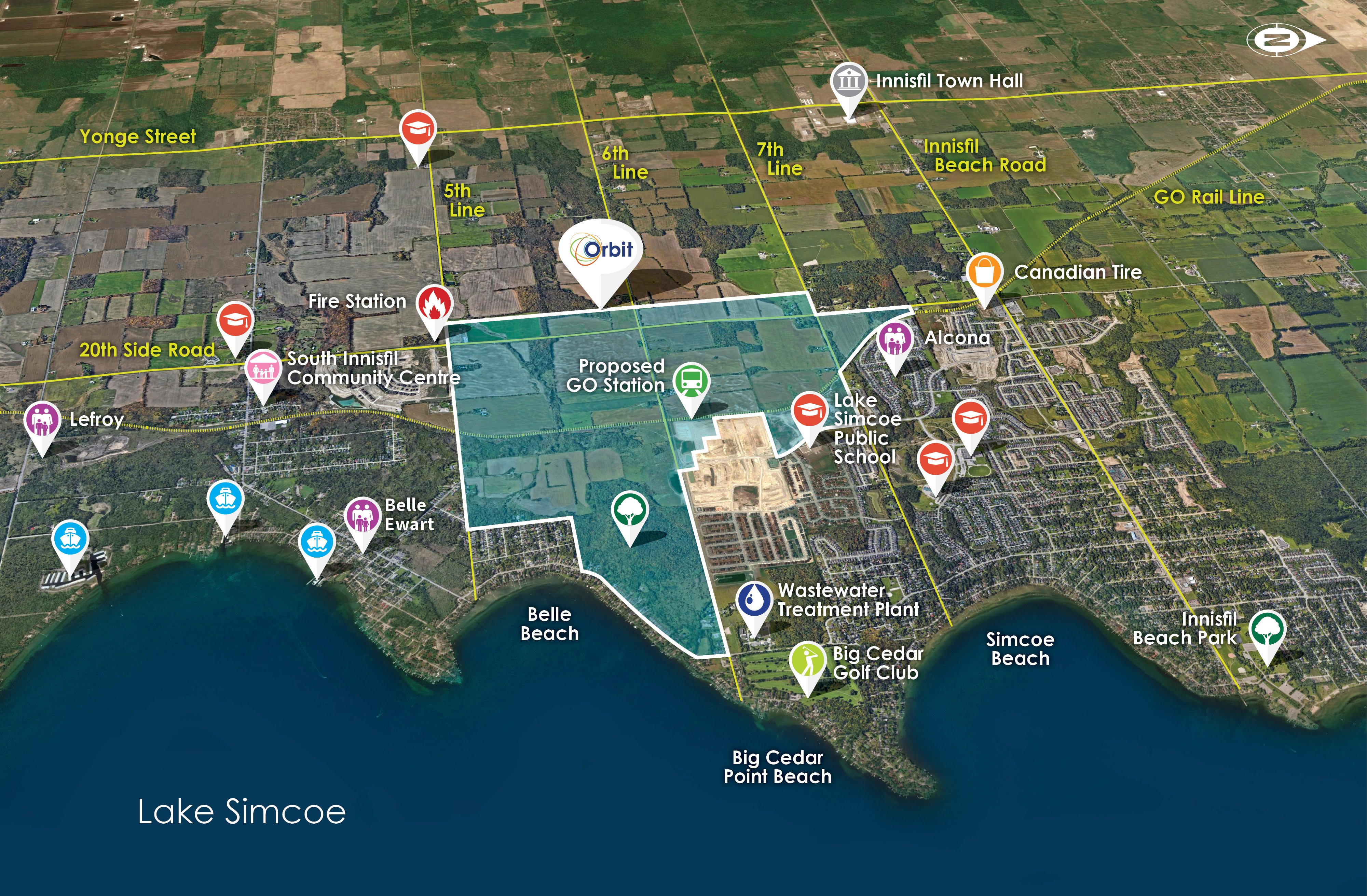
The below figure demonstrates the general location of the area that will be developed using the Orbit Potential & Innovation Plan (OPIP). The OPIP is currently in the early stages of being drafted and the Town of Innisfil is welcoming the public to participate in upcoming engagement opportunities. Check out the Get Involved page for more information!
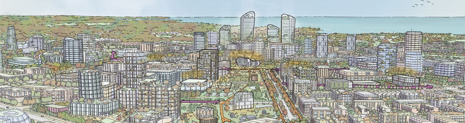
Growth Vision
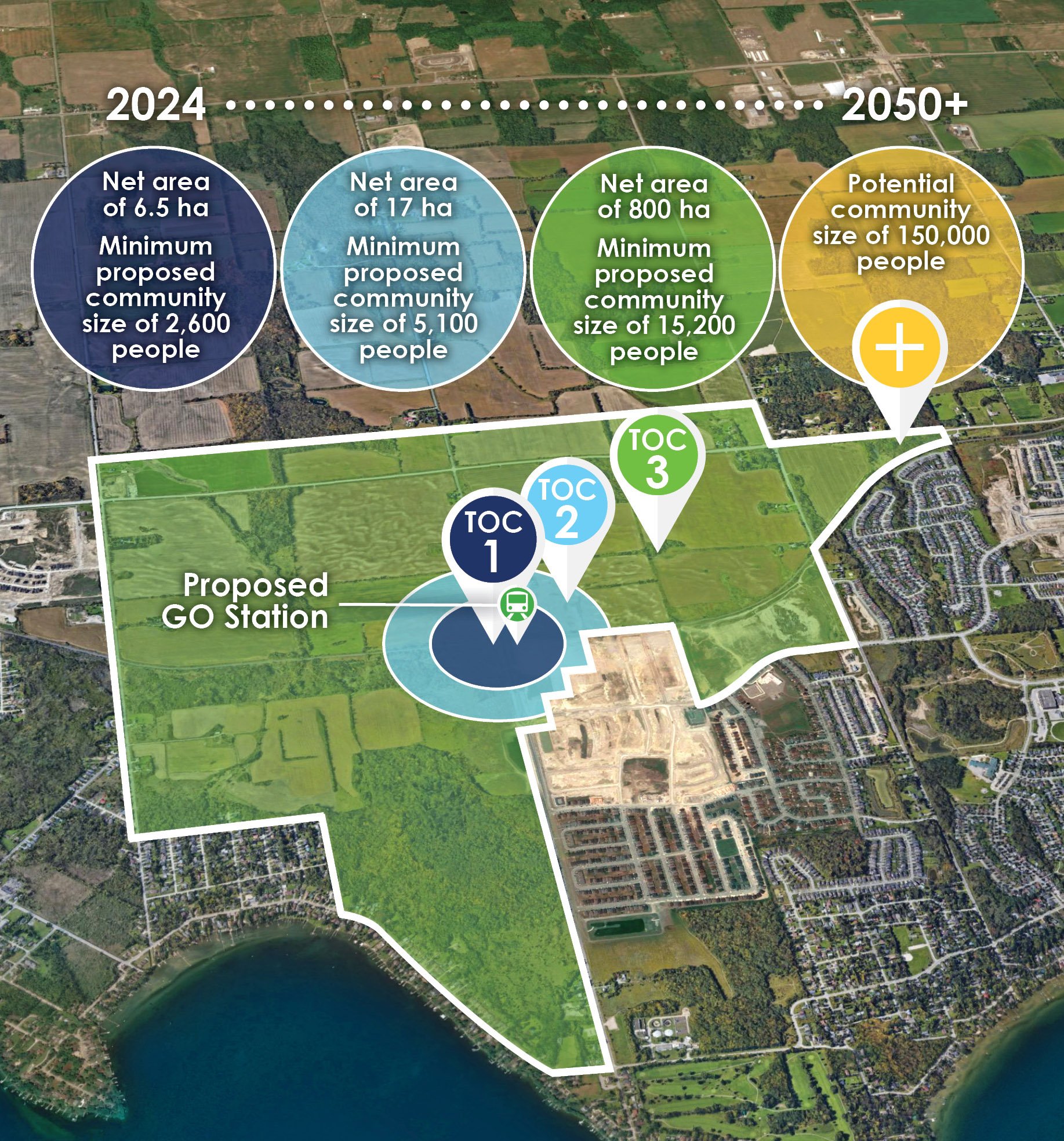
The following graphic shows the anticipated growth the Town of Innisfil is forecasting for the area to be planned by the OPIP. The County of Simcoe has estimated that at least 7,700 people will live in Orbit’s TOC 1 and TOC 2 though their preliminary Municipal Comprehensive Review (MCR) process. The County of Simcoe will potentially allocate 7,700 people to Orbit’s TOC 1 and TOC 2 though their preliminary Municipal Comprehensive Review (MCR). The preliminary estimate is based on the County’s Draft Land Needs Assessment and the MZO minimum densities. This minimum growth is anticipated up to 2051, however, future MCR processes will re-examine population growth within Innisfil and therefore population forecasts and targets will be subject to change beyond 2051. Based on a preliminary analysis of constraints and potential built form patterns, the Orbit could ultimately accommodate approximately 150,000 people at completion, but this is much further in the future and subject to consultation and technical review.
Where are the Transit Oriented Communities areas?
The Transit Oriented Communities (TOC) 1, 2 and 3+ are centred around the proposed Innisfil GO Station and as a whole, the Orbit may ultimately house up to 150,000 people. Initial planning rules have been established by the Province (through Ministerial Zoning Order August 2021) for TOC 1 and TOC 2. OPIP policies will help establish the form and timing of development moving forward.
TOC 1
- Applies to the area within a 225-metre radius from the centre of the Orbit (yellow area)
- Minimum density within TOC 1 is 200 dwelling units per hectare
- The minimum building height in TOC 1 is 6-storeys and the maximum is 40-storeys
TOC 2
- Applies to the area beyond a 225-metre radius and within a 425-metre radius from the centre of the Orbit (blue area)
- Minimum density within TOC 2 is 150 dwelling units per hectare
- Minimum building height in TOC 2 is 4-storeys and the maximum is 15-storeys, unless the building fronts onto 6th Line, in which case it is 25-storeys
TOC 3+
- TOC 3+ applies to the area beyond TOC 1 and TOC 2 and includes a net area of 800 hectares
- Looking to the year 2050 and beyond, TOC 3+ may ultimately house up to 150,000 people